
UAV/RPAS Drone Precision Agriculture Photography
Multispectral Capture and Analysis
Airborne Recon Canada is a UAV/RPAS provider that is based in Hamilton, Ontario – and services clients across Canada.
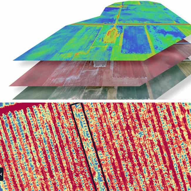
With our precision agriculture services, we use a 5 band multispectral camera to measure light reflection from your crops. The maps that are generated can determine crop health, water stress, pest and weed areas, fertilizer levels, and more.
The map to the right shows healthy vegetation in green and vegetation that is stressed in yellow (NDVI) The other 4 spectrums will detail the source of the problem.
Save on water, fertilizer, pesticide, and herbicides with early detection and targeted application. You can save more than you spend on the survey!
To learn more about our precision agriculture services, Contact Airborne Recon Canada today at 905-517-8572 or email us at info@airbornerecon.ca